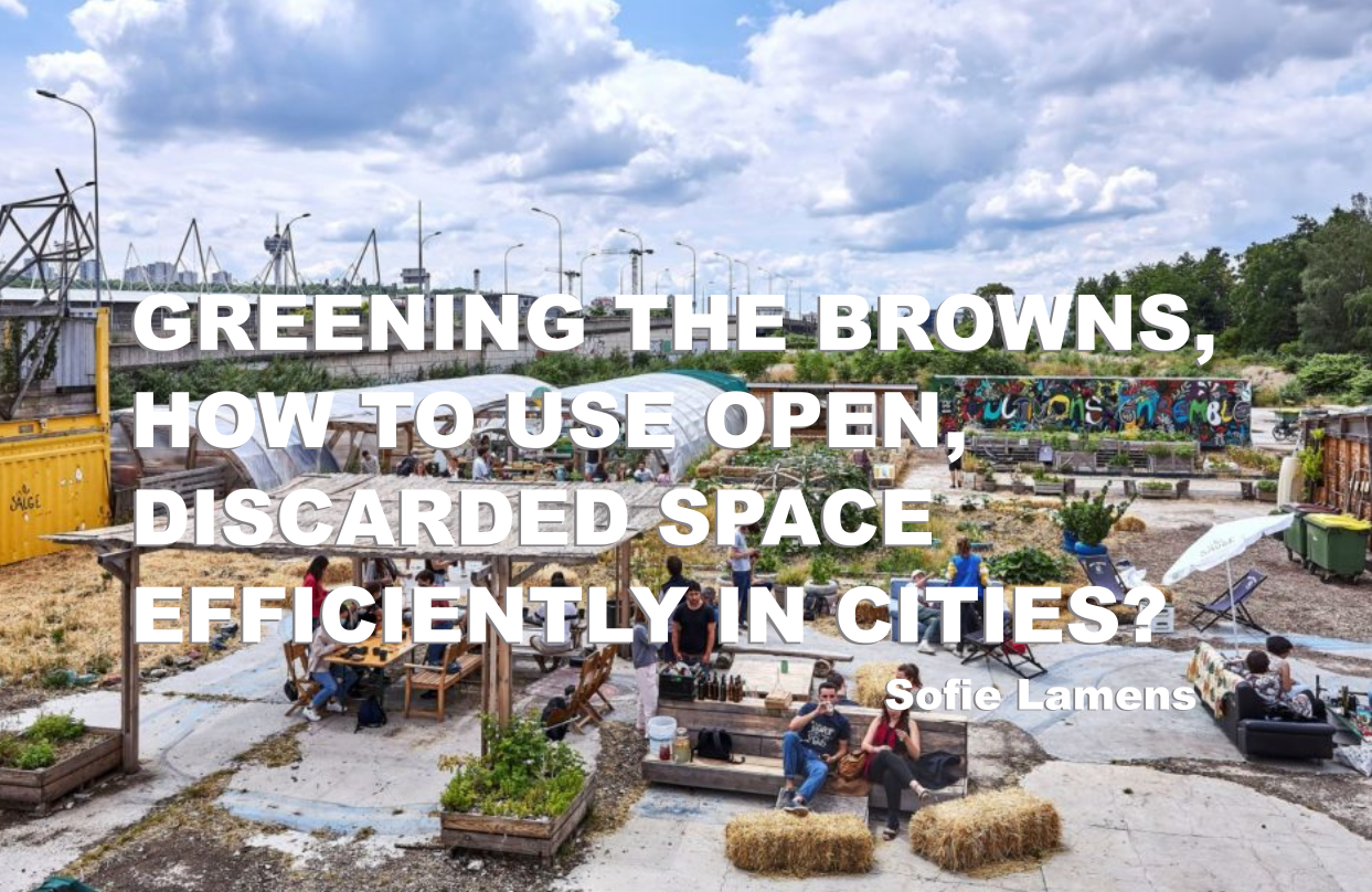
Article de Sofie Lamens (EnvIM 2020)
Europe has seen a remarkable densification of transport networks and cities in the last 50 years, which has led to the splintering of different forms of land use. Even after 50 years, urban sprawl is still increasing. Around 28% of land area of the EU was strongly fragmented, of which cities and towns are the most fragmented areas. Arable and permanent croplands, as well as pastures and farmland mosaics, are most affected by strong fragmentation pressure. These types of landscapes will be referred to as rural areas in this article. Of all European countries in 2015, Luxembourg (91%), Belgium (83%), and Malta (70%) had the largest proportions of strongly fragmented landscape as a proportion of their area [1]. In Figure 1, a map is shown indicating the fragmentation throughout Europe.
![Figure 1: Map of Europe with the ratio of fragmentation defined by different parameters. Scale of 1:2000km. For more information, visit source [1].](https://blog-isige.minesparis.psl.eu/wp-content/uploads/2021/10/Image1-1.png)
Slowly but surely, the effect of this landscape fragmentation on our nature is very visible. One of the main effects is the loss of biodiversity (the variety of living organisms on Earth) due to the loss of open space. This loss causes an imbalance in ecosystems, which are communities of living organisms that live and interact with each other and their non-living environment [2]. Biodiversity provides many goods and services essential to human and societal needs, as well as all life on earth. These ‘ecosystem services’ include food and nutrition security, energy, development of pharmaceuticals, freshwater, leisure activities, and many more services linked to the wellbeing of humans [3]. The negative effect on biodiversity is mostly felt in the areas that are most affected by fragmentation pressure, thus areas with low population density such as rural areas [1].
![Figure 2:Overview of the different ecosystem services identified: These are Provisioning services, Regulating services, Supporting services, and Cultural services. Some examples are shown with some categories [4] .](https://blog-isige.minesparis.psl.eu/wp-content/uploads/2021/10/Image2-2.png)
The solution to these problems could be seen as simple: stop urban sprawl and use the open space in cities that remain to save space in rural areas. However, with 75% of the European population living in cities, open and green space is also becoming important for the well-being and quality of life in urban areas [5]. By using these open spaces, urban environments can lose ecosystem services such as climate regulations, biodiversity, cultural-, and recreational services [5].
This duality of the conflict can be perfectly highlighted with the dilemma around brownfield development in cities, which will be the topic of this blog article [5].
Urban brownfields: a complex area with many opportunities
The definition of a brownfield is very country-dependent and complex (see below) but can, in general, be seen as abandoned land with a variety of historical uses (industrial, commerce, military,…). This history often causes brownfields to have environmental and health risks, as well as economic and social costs. Abandoned industrial land is, for example, potentially polluted with heavy pollutants such as metals, pesticides, and petroleum compounds. There are estimated to be three million brownfield sites across Europe by the European Environment Agency [6]. No centralized definition exists for a ‘brownfield’ in the European Union, as well as common policies related to them. In countries with low population densities, brownfields are mostly understood as heavily polluted (or contaminated) sites. While in countries with high population density and land competitiveness prevailing, ‘brownfield’ is more related to abandoned or underused land [7]. In the latter, brownfields are often well connected within a city and offer a competitive alternative to undeveloped sites. These sites are still potentially contaminated but to a lesser extent. The latter kind will be the focus of this article [6].
![Figure 3:panel a-c are pictures of succession stages of abandoned land in Eastern-Europe [8], while d is a picture of ‘ la prairie du canal’, an event area with urban farm located on the terrain of an old motorcycle factory [9], [10].](https://blog-isige.minesparis.psl.eu/wp-content/uploads/2021/10/Image3-2.png)
Some urban brownfields have been abandoned for so long that they become significantly covered by tree, shrub, and grass vegetation. For that, these types of brownfields contribute to urban green space and can host particular urban ecosystems which offer the ecosystem services as mentioned above [5]. In a study by Muratet et al. [11], 58% of the plant species richness in the Hauts-de-Seine department (next to Paris) was shown to be present in urban wastelands, while other studies showed that brownfields can harbor more species than other urban green spaces (such as managed parks, lawns, and urban forests) [12].
In a study by Pueffel et al. [5], a first empirical analysis was performed on the use of ecosystem services of green, urban brownfields by people in Leipzig, Germany. Pueffel et al. [5] showed that the most important aspect of green brownfields is the cultural services they provide to people as a closer alternative to parks, for example for dog walkers. They are also seen by people as places of solitude away from crowds, which cannot be provided by more formal parks. The provision of urban wilderness and nature was also identified as a valuable asset for locals. Finally, the analysis of the use of these brownfields by urban dwellers can show which needs and desires are not met by the current ‘formal’ public green spaces. It is an indicator for spatial planning and shows the potential of these specific areas for green redevelopment.
![Figure 4: Advertisement for the ‘The Charleroi Adventure City Safari’, a walk throughout the city of Charleroi’s abandoned industrial sites and brownfields [13].](https://blog-isige.minesparis.psl.eu/wp-content/uploads/2021/10/Image4.jpg)
Negative perceptions of these natural green brownfields are also seen, such as the idea that the spontaneous vegetation is a sign of ‘unattendance’ of the site. However, the level of disturbance experienced by the surrounding inhabitants is highly dependent on the age, gender, income, cultural background, and knowledge level of people around brownfields [5].
Even though many brownfields have developed their own habitats and developed themselves into cultural landscapes, health and environmental risks might still be coupled to these areas. This is mostly due to soil contamination caused by their historical uses. Potentially toxic components can still linger on the site and might influence the health of those regularly visiting it (mostly by dermal contact, oral ingestion, and particle inhalation) and species living on it. Especially children are a concern for long term effects, as they are most likely to come into contact with the soils in recreational sites [14]. For this, remediation might be more of a necessity than a luxury.
Remediation processes are numerous and will be selected on the required risk reduction necessary for future use. The process will also need to satisfy time, cost, and place restrictions. Specifically, the cost of soil remediation is a challenge for many communities [7].
Often, the ‘dig and dump’ approach is used in brownfield redevelopment projects, in which the ground is dug out and treated off-site in specialized facilities. This makes the soil sterile and not usable for the original location, hence why this technique is frequently followed by the extensive development of these brownfields for residential or infrastructure uses. This is a fast and efficient method that mostly focuses on stopping the contamination from migrating. Recently, alternative remediations are more based on the permanent treatment of the soil on the location itself, but this asks for a higher time- and resource investment [7]. In general, conventional remediation technologies often pose secondary negative impacts due to the remedial activity: high traffic, emission of CO2, noise, and the consumption of non-renewable resources (fossil fuels and gravel as refilling material) [7]. It also pushes the development of the site to unopen landscapes with less green than originally there.
Next to this, communities often lack the necessary funds to tackle a redevelopment project. The financial barriers are mostly i) the high cost of remediation and investigation, ii) the low demand and value of the land, iii) the long-time span of a project, and iv) the high uncertainty and risks compared to the use of unused land. A recent conference of the European Commission gave a phased approach for redevelopment as a possible solution for communities to overcome this problem [15].
Plant-based gentle remediation options: the best of both worlds?
As shown above, both arguments exist for the remediation of the site into newly, usable land for construction, as well as keeping the brownfield as it is and letting it serve as a new form of urban wilderness in expanding cities. This debate caused researchers to look for less invasive alternatives known as ‘gentle’ or ‘green’ remediation options (GRO) [7].
Plant-based systems to remediate soil pollution, or phytoremediation, are now also referred to as Gentle Remediation Options (GRO). With this technique, plants are used to extract, degrade, absorb or immobilize pollutants in the soil [6]. An overview of all these different plant-based remediation options is shown in Figure 5 [16].
![Figure 5: Mechanisms involved in phytoremediation. The mechanisms in phytoremediation can be a combination of many or just one as the main focus, adapted from Gomes [16].](https://blog-isige.minesparis.psl.eu/wp-content/uploads/2021/10/Image5-1.jpg)
In general, the potential of soil phytoremediation is highly dependent on the type of contaminants and the time scale in which it wants to be used. In Figure 6, an overview is given of which contaminant fits which phytoremediation best [7]. The main gain of using GRO is the return of ecological soil functions, as well as effective risk management of the soil itself. As this remediation technology doesn’t involve a ‘hard’ build-up of the site, this methodology is also seen as ‘soft’ reuse and allows to have greenery in places where it is shown to be necessary.
![Figure 6: Overview of the phytoremediation potential of some contaminants and their remediation potential with phytoremediation. Adapted from The Public Waste Agency of Flanders (OVAM) [17].](https://blog-isige.minesparis.psl.eu/wp-content/uploads/2021/10/Image6.png)
An example of this approach is the ‘industrial forests’ in the Rurh region of Germany, where long-term remediation is being achieved by natural processes on 10 000 ha of intensely polluted land. This project took 22 years to reach its full potential [7].
![Figure 7: Image of the Rurh region in Germany, where phytoremediation is used to stabilize the soil pollution The new forests have become educational and recreation sites for the region’s inhabitants [18].](https://blog-isige.minesparis.psl.eu/wp-content/uploads/2021/10/Image7.jpg)
In the work of Gomes [16], a SWOT (Strength, Weaknesses, Opportunities, Threats) analysis was demonstrated to assess the potential use of phytoremediation on brownfields. A weakness of phytoremediation is its applicability, as only moderately contaminated land can be remediated with this technology. As the process is slow, further migration of the pollution is still possible and intensive study is needed to make sure phytoremediation will be sufficient to stabilize the entire pollution plume. An example lies in brownfields located by river banks. During potential flooding, pollutants can still reach groundwater and a buffer is necessary to prevent this from happening. In general, case-by-case risk management is necessary to eliminate further contaminations and risks during the remediation process itself. The main threat surrounding the GRO is what will happen to the biomass that performs the phytoremediation. As the biomass is potentially contaminated by the pollutants it remediates, the processing of the biomass can become very complex. On top of this, the slow remediation process implies more insecurity and lower economic benefits.
Next to the strengths already explained earlier, phytoremediation was shown to be 50% less expensive than alternative remediation technologies. Opportunities lie in the fact that it can be combined with more conventional remediation technologies. Phytoremediation can be seen as a temporary phase in a treatment chain, in which the financial burden can be spread over many years and the site can act as a habitat for biodiversity during this time. In the meantime, new brownfields can develop and the process of greening can start again, granting a new space for the developed biodiversity of the old brownfield site. This dynamic nature of an urban environment was advised to be integrated with temporary conservation practices for the habitats present [12].
Another opportunity lies in the general acceptance of people surrounding phytoremediation, as it brings green to a site [16]. Earlier research shows that when regeneration programs do not involve local community views about the quality of the brownfields’ landscape, a lack of acceptance and negative public reactions are often a result. The site’s attractiveness and presence of a green space play an active role in the community appreciation of sites and research suggests that these elements deserve more attention in brownfield projects [6]. In general, phytoremediation has the flexibility to preserve specific, historic elements (such as industrial relics) or nature to fulfill this need.
![Figure 8:Collection of pictures of the Westergaspark close to Amsterdam. An old gas factory is transformed into a cultural park and event hall with restaurants. Phytoremediation is present by the trees and the water is used to stop the pollution from spreading [19], [20]](https://blog-isige.minesparis.psl.eu/wp-content/uploads/2021/10/Image8.jpg)
How to green the brown?
So how do we define the future of a brownfield as fitting as possible in an urban setting?
Chowdhury et al. [7] defined a first framework to make more structured decisions on a bio-based land-use approach for a brownfield. In this, they want to conceptualize benefits, remediation potential, time scale, and site-specific requirements to use phytoremediation.
The first step was defining Urban GreenSpaces (UGSs) with the potential to work for brownfields and linking those to specific ecosystem services. UGSs are vegetated, open places that were shown to be important for citizens’ physical and emotional well-being, as well as serving a variety of ecological functions. The Green Surge project of Europe inventoried 44 relevant UGSs for European cities in 8 categories [7]. From this list, 14 were selected to be relevant for brownfields in Chowdhury et al. [7], including grassland, historical park, tree meadow, and others. Interested readers are highly advised to read the article fully to read more about the UGSs and their characteristics.
After this step, a scatter diagram and decision matrix was built. The scatter diagram shows the different, proposed UGSs with the development timeframe of the UGC and the intervention intensity (information, stakeholder commitment, capital) [7]. The one developed by Chowdhury et al. [7] is shown in Figure 7. As can be seen, the longer the realization time and intervention requirement, the higher the permanency of the UGS on the brownfield.
![Figure 9: The scatter diagram proposed by Chowdhury et al.[7], showing the UGS options according to their realization time and intervention requirement.](https://blog-isige.minesparis.psl.eu/wp-content/uploads/2021/10/Image9.png)
The decision matrix is supposed to help decision-makers in a more case-specific approach. Here, basic conditions of the brownfield are linked to green land use options. The decision matrix is shown in Figure 8A. Every basic condition which is suitable for a specific UGS is listed in the column of that specific UGS. In case the basic condition is present on a brownfield, the box can be marked as green. In case it is not, it can be marked as brown. The box can be marked yellow in case the basic condition can be altered or will be altered in the future, while a grey box can indicate that there is uncertainty surrounding the basic condition. The more boxes are colored green in a specific column, the better the UGS can fit on that brownfield as a land-use option. In Figure 8B, an example of the decision matrix applied on the Fixfabriken site in Gothenburg (SE) [7].
![Figure 10: A) Decision matrix as assembled by Chowdhury et al. [7]. B) The decision matrix applied on the Fixfabriken site (n.r. = not relevant). The greener a column shows, the more suitable a specific UGS for that specific brownfield. Here, building greens and spontaneous vegetation would be the highest-ranked UGS alternatives.](https://blog-isige.minesparis.psl.eu/wp-content/uploads/2021/10/Image10.png)
The work of Chowdhury et al. [7] is only one of the first empirical works to determine a framework and should be built on further in the future. Lacking now to stimulate the further use of bio-based land development is the lack of policy guidelines surrounding biobased solutions and the lack of knowledge around the usefulness and effectiveness of GROs in a brownfield context.
Conclusion
To conclude, using a bio-based approach to redevelop brownfield sites will always need a case-to-case approach. Phytoremediation is most interesting for sites with moderate contamination and strategic locations within the city. A community-centered approach, as well as a detailed risk assessment, is necessary to account for both of these variables. However, the greening of brownfields might offer a good alternative to provide unique biodiversity and leisure areas for an urban population. Brownfield projects should be assessed based on a full range of requirements: economic, health, social, and ecological. This will not only form a sustainable development strategy for the city but will also increase the positive image of these projects for the population. Even though future planning might need these sites to be intensely developed again, this temporary, cost-effective remediation phase will spare costs for the communities and bridge periods where new brownfields might develop. Important is to identify all stakeholders in the project and make sure the valuable aspects of the current site are assessed to the fullest.
–
Biblio
[1] European Environment Agency, “Landscape Fragmentation Pressure and Trends in Europe,” 2019. https://www.eea.europa.eu/data-and-maps/indicators/mobility-and-urbanisation-pressure-on-ecosystems-2/assessment (accessed Jun. 24, 2021).
[2] G. M. Mace, K. Norris, and A. H. Fitter, Biodiversity and ecosystem services: A multilayered relationship, vol. 27, no. 1. Elsevier Ltd, 2012, pp. 19–26. doi: 10.1016/j.tree.2011.08.006.
[3] WHO, “Biodiversity and Health,” Jun. 03, 2015. https://www.who.int/news-room/fact-sheets/detail/biodiversity-and-health (accessed Jun. 24, 2021).
[4] Earthwise Aware, “What are Ecosystem Services?” https://www.earthwiseaware.org/what-are-ecosystem-services/ (accessed Sep. 29, 2021).
[5] C. Pueffel, D. Haase, and J. A. Priess, “Mapping ecosystem services on brownfields in Leipzig, Germany,” Ecosystem Services, vol. 30, pp. 73–85, Apr. 2018, doi: 10.1016/j.ecoser.2018.01.011.
[6] Science Communication Unit – European Commission, “Science for Environment Policy: Brownfield Regeneration,” Bristol, Mar. 2013. Accessed: Jun. 24, 2021. [Online]. Available: http://ec.europa.eu/science-environment-policy
[7] S. Chowdhury, J.-H. Kain, M. Adelfio, Y. Volchko, and J. Norrman, “Greening the Browns: A Bio-Based Land Use Framework for Analysing the Potential of Urban Brownfields in an Urban Circular Economy”, doi: 10.3390/su12156278.
[8] W. Zgłobicki, K. Karczmarczuk, and B. Baran-Zgłobicka, “Intensity and Driving Forces of Land Abandonment in Eastern Poland”, doi: 10.3390/app10103500.
[9] la SAUGE, “La prairie du canal,” 2017. https://www.canalprairie.fr/ (accessed Sep. 29, 2021).
[10] les 48h de l’agriculture urbaine, “Dimanche à la Prairie du Canal : ateliers, rencontres, concert…” https://www.les48h.fr/evenements/dimanche-a-la-prairie-du-canal-ferme-historique-de-la-sauge-a-bobigny/ (accessed Sep. 29, 2021).
[11] A. Muratet, N. Machon, F. Jiguet, J. Moret, and E. Porcher, “The Role of Urban Structures in the Distribution of Wasteland Flora in the Greater Paris Area, France”, doi: 10.1007/s10021-007-9047-6.
[12] S. Bonthoux, M.
Brun, F. di Pietro, S. Greulich, and S. Bouché-Pillon, “How can wastelands promote biodiversity in cities? A review,” Landscape and Urban Planning, vol. 132. Elsevier, pp. 79–88, Dec. 01, 2014. doi: 10.1016/j.landurbplan.2014.08.010.
[13] VisitWallonia, “The Charleroi Adventure City Safari, a new way to discover the city.” https://walloniabelgiumtourism.co.uk/en-gb/content/charleroi-adventure-city-safari-new-way-discover-city (accessed Sep. 29, 2021).
[14] V. Pecina, D. Juřička, M. Vašinová Galiová, J. Kynický, L. Baláková, and M. Brtnický, “Polluted brownfield site converted into a public urban park: A place providing ecosystem services or a hidden health threat?,” Journal of Environmental Management, vol. 291, p. 112669, Aug. 2021, doi: 10.1016/j.jenvman.2021.112669.
[15] DG Environment, “Brownfield redevelopment in the EU,” in Brownfield redevelopment in the EU, Apr. 2019, pp. 1–3. Accessed: Jun. 25, 2021. [Online]. Available: https://ec.europa.eu/info/sites/default/files/brownfield_conference_report_0.pdf
[16] H. I. Gomes, “Phytoremediation for bioenergy: challenges and opportunities,” Environmental Technology Reviews, vol. 1, no. 1, pp. 59–66, 2012, doi: 10.1080/09593330.2012.696715.
[17] J. Vangronsveld et al., “PHYTOREMEDIATION: Code of Good Practice,” Code of Good Practice. OVAM, p. 130, Jan. 2019. Accessed: Jun. 30, 2021. [Online]. Available: https://www.ovam.be/sites/default/files/atoms/files/Code of Good Practice Phytoremediatio 29082019.pdf
[18] Nord Rhein West Falen, “Industrial Forests of the Ruhr: plants & wildlife vs. coal fields.” https://www.nrw-tourism.com/industrial-forests-of-the-ruhr (accessed Sep. 30, 2021).
[19] Landcom, The University of Newcastle, UTS, and UNSW, “Westergasfabriek_NL,” Power plants phytoremediation, 2018. https://powerplantsphytoremediation.com/landschaftspark-1 (accessed Sep. 30, 2021).
[20] Arup, “Westergasfabriek.” https://www.arup.com/projects/westergasfabriek (accessed Sep. 30, 2021).